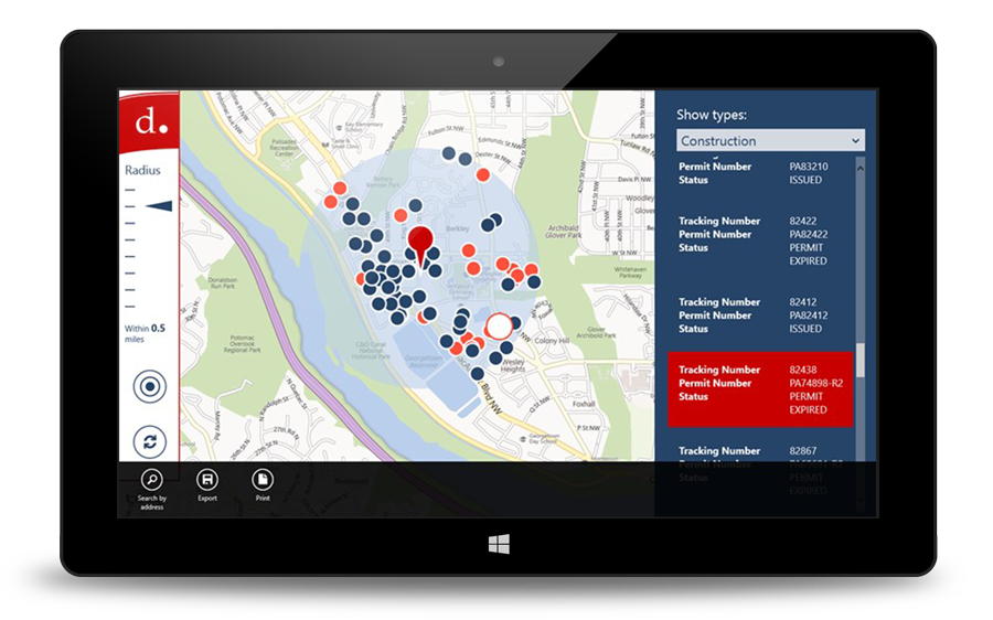
Providing accurate, up-to-the minute information about public space-related permits had proved a challenge for the Washington DC Department of Transportation (DDOT). It needed a real-time mobile app that would enable users to locate and view permits on an interactive map along with real-time information about the permit. The solution? The Windows Tablet Public Space Permit Viewer. The app displays and maps current permit data based on a specific address or nearby landmark and includes filtering, zoom, and export capabilities for ease-of-use.


