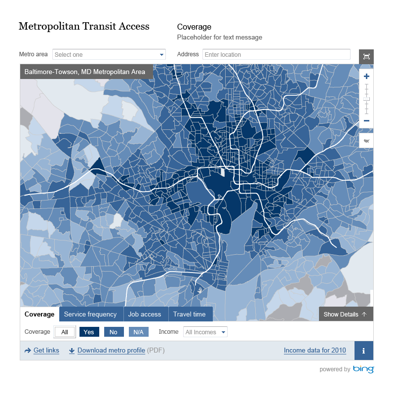
Developed for the Brookings’ Institution, the Metropolitan Transit Access interactive tool uses the power of the cloud and Bing Maps to correlate, analyze, and map data from across the nation’s largest metro regions. The tool reveals the performance of individual transit systems across numerous data points including cities, suburbs, and different income neighborhoods, for enhanced visualization of coverage and service frequency as well as job access data.


